Westchester Square Bronx, NY
Go to Github Page

Quick Facts
General
- The zip codes of this neighborhood are 10461 and 10462.
- According to 2010 census figures that group the Westchester Square area with Unionport, 6.5 percent of the 27, 248 residents were white, 15.5 percent African-American, 10.7 percent Asian and 62.1 percent Hispanic.
- The census tracts encompassing this neighborhood are as follows: 0256.00; 0204.00; 0206.00; 0202.00; 0200.00; 0096.00
Location
- About 14mi. away from Federal Hall (40min drive or 1 hour 10min subway commute).
- About 11mi. away from Empire State Building (35min drive or 50min subway commute).
Top Parking Offenders
| Plate ID | Tickets |
|---|---|
| BLANKPLATE | 256 |
| 85992MD | 104 |
| 62926JM | 94 |
| 95409MD | 94 |
| 54630JT | 93 |
| 30899JX | 89 |
| 51766JW | 84 |
| 62920JM | 81 |
| 55059MB | 79 |
| 12414MH | 78 |
Top 311 Service Complaints :sweat:
| Complaint Type | # of Complaints |
|---|---|
| HEATING | 20862 |
| Residential Noise | 19729 |
| HEAT/HOT WATER | 18153 |
| Blocked Driveway | 11060 |
| Street Light Condition | 9698 |
| PLUMBING | 8683 |
| Street Condition | 7960 |
| GENERAL CONSTRUCTION | 7274 |
| Illegal Parking | 6451 |
| PAINT/PLASTER | 5559 |
Service Complaints encompass all of zip codes 10461 and 10462
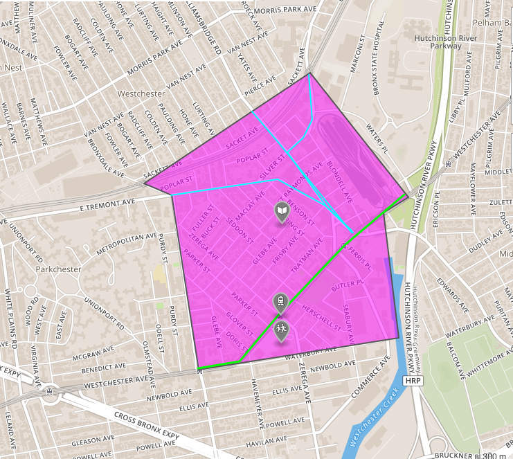
- name of the neighborhood
- outline of the neighborhood
- basic demographics & statistics
- top ten for parking tickets
- biggest 311 complaints
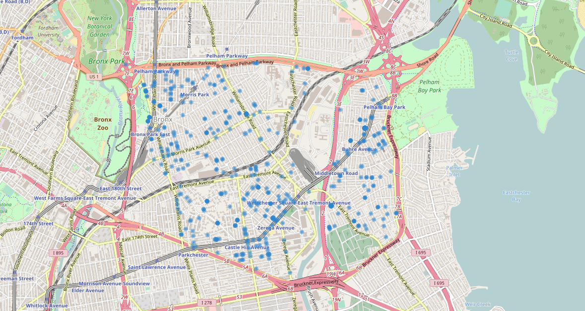
- map of where 311 complaints occurred
Other Maps
<iframe src="https://www.google.com/maps/embed?pb=!1m18!1m12!1m3!1d12073.635695779354!2d-73.85599831551302!3d40.84094495248063!2m3!1f0!2f0!3f0!3m2!1i1024!2i768!4f13.1!3m3!1m2!1s0x89c2f4b3db81ba09%3A0x89bc72fd3496954!2sWestchester+Square%2C+Bronx%2C+NY!5e0!3m2!1sen!2sus!4v1490391989852" width="600" height="450" frameborder="0" style="border:0" allowfullscreen></iframe>

<script src="https://embed.github.com/view/geojson/<shellwayne01>/<shellwayne01.github.io>/master/shellwayne01.github.io/WestchesterSquare.geojson">
</script>